My dear friend and birthday buddy, Guy Falskow, loves boats. Mike and I have had the pleasure of visiting Guy and hs wife, Betty, at their lovely beach home near Gig Harbor, WA where Guy owned a beautiful wooden Chris Craft which he had restored to a state of glory. Guy (who is as excited as we are about this Loopy adventure) has been following the travels of Velsignet and regularly checks in with us to confirm our current location. Today, however, Guy called to set us straight (so that we don't end up in Minneapolis by mistake): Columbus--near where we anchored last night--is in Mississippi, not Alabama; and Joe Wheeler State Park is in Alabama, not Tennessee. We've been busted!
Because of the unknown about how the boat will handle in varying conditions, the weather, the waterways, the people, the places along the way (seems EVERYTHING is different or changeable.. except for possibly the two of us...but then again, Brenda can be unpredictable....hmmmm), it's important that we plan and anticipate (for the worst, hope for the best) before we set out each day. So far, we've found that we can only plan and anticipate for the short term. Our brains get overly taxed and our mental capacity to plan farther out gets depleted. For example, we entered into our first lock yesterday without armoring the boat with the proper fenders (like, NO fenders!). How did THAT happen?
Before we began this trip, many people posed questions to us in regards to the route we'd be taking, locations we would stop, our return back home for visits. They were way ahead of us! We were still trying to figure out how we would bank, receive mail, decrease our storage needs, have our lake home occupied, prepare the yard and house for winter, etc. And now we are finally here living on Velsignet (for 3 full days) and we strive to stay on task to the plan we've set before us and anticipate into the next day. Note to self: Keep aware of the state we're in. Note to self: Need to get a road atlas so we have a bigger picture of our location. I wonder if we have one on board?
Gotta go!!!! We are at Glover Wilkens Lock and the Lockmaster just called Velsignet on the VHF radio. He asked if we were going upriver through the next lock. In haste, I said "Yes." Now need to check the Aquamaps program to see if it is in fact part of the route Mike charted for the day!
 |
| Today we went through 5 (yes, f-i-v-e) locks. As we were waiting to enter our first of the day, the Stennes Lock, we decided to shine up the isenglass on the flying bridge. The world seemed so much brighter afterwards! |
 |
| This is near the Port of Amory where we are reminded that forest products are responsible for much of the industry along the Tenn-Tom. According to author Fred Myers, large machines grind up about 30 trees in one gulp! |
 |
| More of the Port of Amory: A large barge being loaded with what looked to us as woodchips. |
 |
| The Tombigbee River is a winding and narrow; The Tenn-Tom Waterway is part of the Tombigbee River, but dredged to create a straight and wide passageway--it shortcuts the Tombigbee and allows for much more efficient transportation for industry and for pleasure boats. Lots of boats designed for fishing enjoy these waters as well. |
 |
| Here's my favorite deck guy! Life jackets are required for anyone on deck by the Lockmaster. As you can see, in the background, the water has raised to the appropriate level. Soon the lock gates will open and we'll hear the lockmaster blast one horn signal that indicates we're free to go on our merry way. |
 |
| The locks have alot of area to fill and empty with water. One can feel a little guilty being the only boat in the lock--all that work for just us. The lockmasters have been very welcoming and helpful to us. Thank you to the US Army Corp of Engineers! |
 |
| It appears that when the Tenn-Tom Waterway was developed, areas were flooded. The dark spots in the water are tree trunks. |
 |
| This is a picture of the water hyacinth which is invading the Tenn-Tom Waterway. We've seen what look like islands of this stuff along the way. Our concern is how it can clog up the strainers on the boat (we have strainers for the air conditioning, generator, main engine, and raw water intake). |
 |
| Industrial vessels have priority over pleasure boats when it comes to locks. This very large tug is pulling barges of wood chips. Mike estimates the barges alone were 600 feet long. The tug hailed from the Port of Minneapolis, MN! |
 |
| This is the same large tug with its barges maneuvering into the Fulton Lock. It looked to us like there was barely a foot to spare on either side of the lock walls. It is humbling to be addressed as "Captain" by the lockmaster when one sees what a real captain is able to accomplish. |
 |
| This is the tug hailing from Minneapolis again, this time in the Fulton Lock. Try and see how there are 3 abreast to fit snugly within the locks confines. The gates will close soon and the lockmaster will fill the lock with water to raise the massive cargo and tugboat up to the upstream water level. Amazing! |
 |
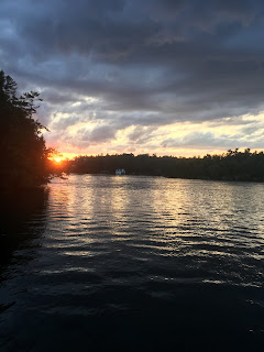
We enjoyed watching the tug and barges ahead of us, but it then put us into dusk before we were in and out of the Fulton Lock. It was harrowing for us to maneuver in the darkness to a safe anchorage. I am still trying not to be angry at the Lockmaster at Fulton Lock as I believe his decision to put the tug in front of us so late in the day put us at risk. Tugs and barges are equipped for night travel; Pleasure boats are not.
Note to self: Darkness creeps in quickly; don't chance it next time! |
 |
| This is Mike and Brenda going through the "getting underway" checklist. We've learned first-hand that its a necessary thing to do each and every time we begin our day of cruising. We've also found that it takes both of us to to complete the checklist. |


Comments
Post a Comment
We would love to hear your comments!