The Big O
This morning, as Velsignet idled past the docked catamaran,
Captain John emerged. Leaning out from
the flying bridge, Brenda thanked John for his advice last evening; all worked
out well for us. John—about our age—gave
us a big fairly toothless smile, took no credit and wished us a great
day. Note to self:
Be more like Captain John and be generous with big smiles and well
wishes!
Preparing for our day, our resources indicated light northerly winds (5 mph or less), sunshine with a high of 78 degrees, and the navigational depth of Lake Okeechobee on Route 1 (Route 1 is across the lake; Route 2 is the rim route) to be 6.1 feet (Velsignet requires at least 4 feet). Lake O is a shallow lake (average depth is 9 feet) and navigation can be tricky, thus it's necessary for a boat like Velsignet to have knowledge of the weather forecast, lake depths, and follow its markers closely to avoid running aground.
Lake Okeechobee is the largest freshwater lake in Florida
and the second largest natural freshwater lake contained entirely within the
contiguous US. Hurricane disasters and deaths in the 1920s resulted
in Florida establishing the Okeechobee Flood Control District, which entails channels,
gates, and a levee that surrounds the lake.
Lake Okeehobee requires continuous management by the US Corp of
Engineers, the State of Florida, and the 5 counties in which it is located. This is complex as flood control, water
consumption, calculating red tide, contending with algae bloom, wildlife
management, fishing and navigation are subsets
of the Big O’s entirety.
And the alligators?
Lake O is said to have the most concentration of them. This is based on a 2006 census whereby two
airboats were able to count 754 alligators…. in only THREE HOURS!
We crossed Lake O from Clewiston and headed northeast to
Port Mayaca. From Port Mayaca, we
cruised on the Saint Lucie canal through Indiantown and anchored just south of
Fort Pierce, next to the Saint Lucie Lock, near the eastern intra-coastal
waterway.
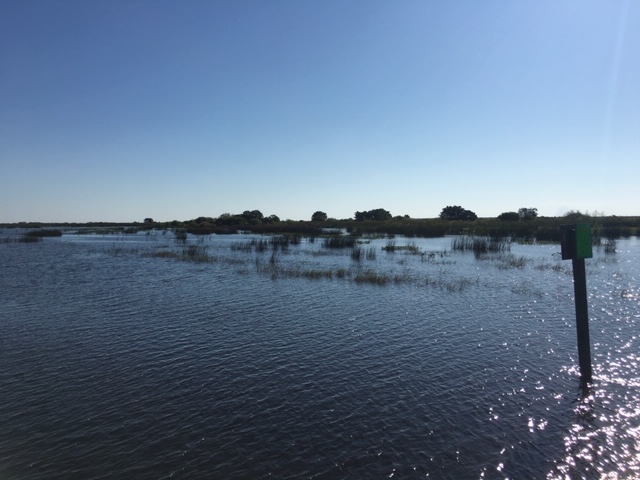 |
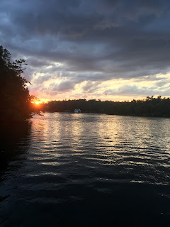
| This photo was taken as we entered onto Lake O. Knowing the lake is shallow, we wondered "Is the entire lake like this?" But as we continued on, we learned differently. |
 |
| This is a structure with a special light on it. We wondered why such a structure would be in the middle of the lake and have found no explanation for it. |
 |
| This was another interesting marker on the lake. |
 |
| These fast boats caught our eye as they sped past us on the lake. These are definitely NOT fishing boats! |
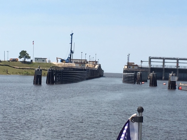 |
| This is the lock at Port Mayaca. Because of the level of the lake, we were able to cruise right through without any rise or fall. |
 |
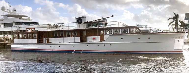
| It took us a bit to appreciate this boat. First, we noticed the size and age and its pristine condition. Looking through our binoculars we saw that it flew a presidential flag! We then put our attention to its name, "The Honey Fitz." See more information in the next photo. |
 |
| This photo of "The Honey Fitz" was taken off the web. "The Honey Fitz" is one of only two yachts that are allowed to fly a presidential flag. The 93-foot wooden motor yacht was originally built in 1931 for Sewell Avery (Montgomery Ward) to entertain guests while cruising the Great Lakes. The yacht was later expropriated by the US Government and assigned to the coast guard and served as a mine sweeper during wartime. After the war, the yacht gained presidential status by becoming the tender for President Harry S. Truman. Since then, it has served 5 US Presidents including Truman, Eisenhower, Kennedy, Johnson and Nixon--but earned the most notoriety during its time under John F. Kennedy, who renamed it "Honey Fitz" after his grandfather. Today, the yacht is privately owned, has undergone extensive restoration, and is known as the "Yacht of Camelot." After a good-will tour, the "Honey Fitz" is available for corporate and private events. |

Comments
Post a Comment
We would love to hear your comments!